Cohasset Harbor to Little Harbor - 7/3
Moderator: Chip


Ok - part II... Sue interrupted me to go over Bea's work. (Ya, like I'm going to get right on that!)
Once I got around to the harbor mouth again, it was now a full two hours after high tide. Current is still moving swiftly, but again - the water was very smooth and appeared to be easily navigable. Just don't plan on changing your mind once you've committed to the trip. Of course, once this rip current meets the ocean and hits the incoming waves, things could get interesting. There's no public access to get out to that area, so we'll just have to find out the old-fashioned way!
Once I got around to the harbor mouth again, it was now a full two hours after high tide. Current is still moving swiftly, but again - the water was very smooth and appeared to be easily navigable. Just don't plan on changing your mind once you've committed to the trip. Of course, once this rip current meets the ocean and hits the incoming waves, things could get interesting. There's no public access to get out to that area, so we'll just have to find out the old-fashioned way!
 Impex Currituck
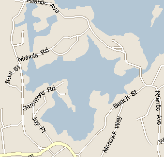
-
Finn McCool

- Posts: 605
- Joined: Tue Jun 28, 2005 1:03 pm
- Location: Cohasset, MA
Hey everyone!
Just got back from a 10 day adventure in California. No Kayaking, but I've made a mental note to get back out to Point Reyes National Park and kayak the relatively serene, protected Tomales Bay area. (Believe me you don't want to be anywhere near the open ocean out there: on Saturday night - we were there for rare tour of the ultra-remote lighthouse at the lands end -- the wind was howling at a steady 50 mph, the famous "marine layer" had fogged the place in with 50 ft visibility...and best of all, the temperature was about 45 F. Seas had to be running 20 ft....judging by the crashing against the cliffs. Typical for the region this time of year.
Then there's the coastal section of Redwoods NP...but enough of that...
Anyway, I've been into Little Harbor by way of Sandy Beach. We parked our vehicle...and portaged over the flats from the beach. The catch: you need a town sticker to park there. It's also a tad muddy even at high tide.
For the record: don't even bother going to Little Harbor near low tide: it's all mud flats.
Next time, we plan to just ride the current in...and ride out. The timing for both Little Harbor and the Gulf River in Cohasset, according to the harbor master, is that things go slack about 45 minutes after high tide. And then you get around 90 minutes to paddle around and get back out before the current starts to really pick up.
Hope everyone is having a great summer.
Alla har rätt till min åsikt!
-
Jim Fitzgerald
- Posts: 9
- Joined: Tue Jun 28, 2005 9:01 pm
- Location: Marshfield
- Contact:
Hey Turkeys!
Well, I finally got to paddle in Little Harbor last night. My friend Greg is housesitting a spectacular house right on the water and invited me over to do some fishing. I was going to do a trip report but frankly, there isn't that much to report.
After all these years of waiting to go fishing in Little Harbor I was underwhelmed by the lack of action. When I finally did hook up with a 14" or so schoolie it was close enough to Cunningham Bridge that the flow of water was carrying me dangerously close to being swept under the bridge. I dragged the fish back up stream and lost it in the process, but better than having the boat smashed (hell, it wasn't even a keeper). No other hits after 1-1/2 hours of fishing.
For those not on the hunter/gatherer side of kayaking, the area is fairly pretty with some large rock outcroppings running down to the water in many places and a number of small rocky islands throughout that were hosting a variety of brids (gulls, cormorants and some larger variety of sandpiper that I have not yet identified). The water runs very shallow in spots and there are a number of barely submerged rocks that could leave you with some impressive scratches on the bottom of your boat. The shore where we were on the south side appeared very mucky where the eel grass was abundant, which would lead me to believe that any portage over from Sandy Beach would be a messy endeavour. Running in from the ocean would, I believe there's a bit of an obstacle course of rocks that one should watch out for (I remember these from my young and stupid days when we used to put on our wetsuits and fins, grab a six pack and jump of the bridge so that we would get swept out to sea- wahoo!).
If one were to rate the Spit with calm water and a beautiful early summer sunrise a 10 and the same spot in November when it's raining and getting pummeled by a full bore ebb tide when you need to go upstream a 1 (been in both, so I know from where I speak) I'd rate Little Harbor as a 5 at best. I think a more interesting trip would be to run up the coast a bit and play in amongst all the little islands off and north of Sandy Beach.
Your intrepid reporter
Jim Fitzgerald
Chesapeake 18