 South River
| Location: | Marshfield, MA |
| Type: | Primarily salt water tidal river, fed by a freshwater stream. Flatwater, with a brisk current near low tide. |
| Tide offset: | Add approx 1.5 hours to the schedule posted for the Willow Street bridge. |
| Satellite image |
 According to the NSRWA blue book, the South River has its origins in northwest Duxbury, but for those of us who like following a river while inside a boat rather than carrying it over un-navigable dams, swamps and bogs, the only realistic starting point is in Marshfield Center, not far from Veteran's Memorial Park.
The park, very popular with the wedding photography crowd, has a small duck pond that empties over a water wheel, into a stream that runs under Rt 3A and behind Marshfield Center's business district.
While a pleasant ride, the South River does have it's limitations for paddlers. Primarily, launch points are scarce. Launching from Marshfield Center is ambitious, difficult, (insert your favorite adjective here...), and may not be worth the trouble.
Update - 2017: A new launching dock has been placed at the end of the path behind CVS.
Fifty yards west on Rt 139 from the park is a sand parking lot with plenty of room (unless an uber-wedding party is having pictures taken). The stream does run past this point, but it's still at it's babbling stage, and it's probably better to just carry your boat down the path and through the park.
Although I haven't tried it, I believe that you should be able to get into your boat within the park and paddle under Rt 3A. Once you get under the bridge, there may be a few spots over the next hundred yards where you'll have to get out of the boat and pull it through shallow areas.
An alternative would be to pull into the Prime gas station right there, unload the boats, park in the aforementioned dirt lot and walk back. However, this launch point is far from perfect.
Behind the Prime station is the start of a promising gravel path that goes along the stream. However, the path ends abruptly after only 50 feet, and the growth in that short distance between the path and the stream is dense and occasionally thorned. A pair of pruning shears might not be a bad idea. The good news is that if you can get through the jungle at the end of that path, the stream becomes totally navigable at this point.
 It's highly recommended that you paddle through this area near high tide, as the passage under the Willow Street overpass is heavily laden with boulders and is completely un-navigable for most of the tide schedule. You could portage over Willow Street, but it wouldn't be the high point of your trip. (Well, it might be in a literal sense...)
Speaking of Willow Street. If the previously mentioned areas could be considered launch points, include the Willow Street on your list of candidates. Just a few feet away from the river crossing is a small pull-off where you could park. I'm not sure if this would be sanctioned by the police, but it looks harmless enough. If you have many cars, there is an abandoned auto service station of some sort on Rt 139 that isn't a long walk from this point.
Update - 2009: The abandoned gas station has been bulldozed away and the area is being converted into "Dandilion Park". There is a possible chance that this park might include access to the river, but that's still undecided at this point.
At any rate, there is a steep narrow path from the road to the river on the east side of the bridge. Boarding a boat at this point might be a two-person job - very cramped quarters.
Just a little further downriver is the Keville Foot Bridge. Unfortunately, I don't see any possible launch opportunities at this point without placing a cherry picker on the bridge. Also, the banks have been heavily overgrown with poison ivy.
Update - 2017: A new launching dock has been placed at the end of the path behind CVS. The poison ivy appears to have been eliminated.
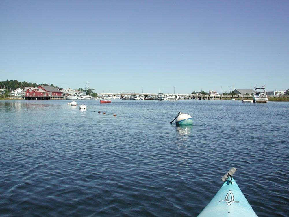
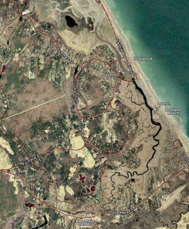
From this point on, the river widens and the landscape becomes a pleasant (but for the most part unchanging) field of marshes until you reach Humarock.
A couple miles down, you will pass the Rexhame Beach area on your right. From a parking perspective, this is probably the best launch point on the river, inconveniently located in the dead center of it's length. Be prepared for a couple hundred yard trek from your vehicle to the river's edge.
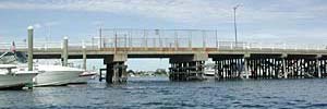
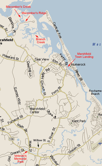
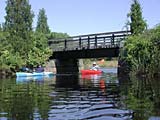
Not too much further down river, you will start to enter the Humarock area. You will pass under the Bayberry/Julian Street bridge, and powerboats (moored and moving) will become more common. Not too long before the Sea Street Bridge is the Marshfield Town Landing. This is a pretty good launch point, although you need a town permit to park here. How strictly that is enforced is debatable.
Slightly closer to the bridge and on the other side of the river is a rather large public parking lot across the street from the Post Office. Parking here would require somewhat of a walk to get to the river, but not too bad.
After you pass the Sea Street Bridge, the river widens considerably. Cottages line the east bank, and varying seas of marsh island fill the inland area. You may see large flocks of cormorants and loons around here. Branch Creek will be coming up fairly soon, allowing safe passage past the North/South river mouth.
The South and North rivers join to empty into the sea. This mouth should be avoided at all costs unless you are a seasoned paddler with rescue skills. Currents are unpredictable, and whirlpools can easily capsize small craft with the current dragging the swimmer out to sea. Fortunately, there is a convenient and very interesting shortcut past the mouth.
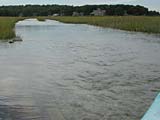 Branch creek leads from the South River behind Trouant's Island and allows easy portage over Macomber's Ridge - a gravel road. If you hit this area at a sufficiently high tide, you can paddle right across the road. The photo to the left, taken from a kayak, shows the road at high tide. The tributaries on the other side of the road will take you to Macomber's Creek, which will in turn dump you into the North River.
Since it's difficult to know what's what from a boat, I'll tell you that the island on the right that is covered with houses is Fourth Cliff - the end of Humarock and the mouth of the North and South Rivers. The island that is primarily tree-covered with a few houses on the left is Trouant's Island. You will ultimately paddle to the left of this.
Once in the North River, it's a fairly short paddle across the river and into Herring Brook, which will lead you to a public launch area off the Driftway in Scituate.
Directions to Veterans' Park in Marshfield Center: Take exit 12 off Rt 3 and head east on Rt 139. Approx 3 miles up, Veteran's Park will be on the left at the corner of intersection with Rt 3A (and a traffic light). The Prime station is right after that light on the left. Willow Street is maybe a tenth of a mile up on the left.
Directions to Marshfield Town Landing in Humarock: Take exit 12 off Rt 3 and head east on Rt 139. About 1½ miles down, take a left onto Furnace St. Follow that road to end (about a mile) and go left onto Ferry St. Stay on Ferry Street, ignoring likely forks. After 2 miles, the road will bend to the left as you get to the river. Right there is the town launch. If you get to an intersection with the Polcari's Bridgewaye Restaurant, you've got about a quarter mile too far.
For more information on paddling the South River, read these two trip reports: